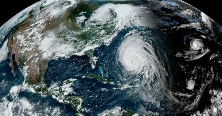
Hurricane Lee Approaches Northeastern United States and Canada
After a journey across the Atlantic that lasted over a week, Hurricane Lee is now inching closer to land, with anticipated impacts on the Northeastern United States and Canada expected as early as Friday. In preparation for the approaching storm, hurricane and tropical storm watches have been issued for most of coastal New England and parts of Canada.
Key Points to Know:
- Bermuda in Lee’s Path: Bermuda is set to experience the brunt of Hurricane Lee’s destructive winds on Thursday into Friday as the storm’s center moves west of the island.
- Potential Landfall: Following its passage by Bermuda, Hurricane Lee is increasingly likely to turn toward the Gulf of Maine, potentially making landfall somewhere between Maine and Nova Scotia.
- Wide-ranging Impact: Due to the storm’s significant size, hazards such as heavy rainfall, high winds, and flooding are expected to extend far from its center, affecting areas in New England and Atlantic Canada as early as Friday.
For nearly two weeks, there has been speculation about the storm’s impact on the East Coast. As of 5 a.m. on Thursday, Hurricane Lee was approximately 295 miles southwest of Bermuda and had sustained winds of 100 miles per hour, classifying it as a Category 2 storm. Although some weakening is expected in the next two days, it is likely to remain “large and dangerous” through the weekend.
Forecasters are confident that Hurricane Lee will move north after passing Bermuda, with a possible turn toward southeastern New England by Friday night and into Saturday. A hurricane watch is in effect for parts of Maine, and the Canadian Hurricane Center has issued a watch for New Brunswick and Nova Scotia provinces.
However, there is still some uncertainty regarding the exact course of the storm this weekend. The outcome for New England will depend on various factors, including the storm’s precise landfall location, which may lead to varying amounts of rainfall.
Anne Strauser, a meteorologist with the National Weather Service, emphasized the importance of monitoring the storm’s development. In Maine, the worst-case scenario would involve the storm shifting farther west, potentially exacerbating coastal flooding. Coastal erosion and flooding remain significant concerns, as dangerous surf conditions have already affected the Eastern Seaboard.
Governor Kathy Hochul of New York has taken proactive measures by deploying National Guard soldiers to Long Island in preparation for the storm. Residents in coastal areas are advised to stay informed about the forecast and be prepared for potential impacts.
As Hurricane Lee moves north over the next few days, it will weaken over cooler waters and transition from a tropical system to one resembling Hurricane Sandy, drawing energy from competing cold and warm air masses. While weakening is expected, the storm’s wide size will still pose a risk of wind, rain, and coastal flooding.
In Canada, officials are concerned about Lee’s broad reach, which is likely to affect most of the Maritime Provinces and parts of eastern Quebec. Hurricane-force winds extend up to 105 miles from the storm’s center, with tropical-storm-force winds extending even farther.
As we approach this storm, it’s essential to remain vigilant and prepared, as Lee’s impact may be felt across a wide area, posing challenges to both the United States and Canada.

